Length 13km; total ascent 620m; expected time 4 1/2 hours.
TODAY’S HIKE IS ON
If there is a spike in air pollution, or fires are reported in the hike area, it may be necessary to cancel. Any notice will be posted on this site before 06.00.
This is a hike that follows a ridge line parallel to, and NW of, Highway 118. There will be a short 3km car shuttle between the start and end points of the hike, at Baan Huai Mo and Wat Prabhat Pang Faen respectively.
The hike starts from close to Baan Huai Mo (but not in the village itself). Initially we pass through open agricultural area, but soon turn off onto a forest trail that climbs steadily up to the ridge line. Once on the ridge line, the plan is to follow the ridge due north to a rocky outcrop, which offers the best views along the entire ridge and makes for a nice picnic stop.
After taking refreshments, we will return along the same trail to the point at which we accessed the ridge and then turn SW in the direction of Baan Pang Faen. After 3km of ridge walking, we turn off on a steeply-descending trail leading back to the vehicles parked at Wat Prabhat Pang Faen.
There are fairly steep sections both up and down, but nothing that should cause any difficulty. Trails are good throughout. The ridge is at an elevation of just over 1,000m and is usually pleasantly cool and breezy. Most of the hike is through forest cover, but take hats and sun protection for the more open sections.
The northern excursion to the rocky outcrop comprises about 3km and 150m of elevation of the quoted hike parameters. Those lacking energy and with plenty of patience, could wait on the ridge for the return of the group, reducing the hike to 10km and 470m of elevation. This would, however, mean a long wait as well as missing the trip highlight.
Hike Organiser: Richard
If you would like to attend: Please read the general information on this site, as well as this particular post. If you still think this hike is for you, then just turn up at the meeting place on the day and time. Lifts in cars are usually available, but cannot be absolutely guaranteed. For passengers, please offer the driver TB100 towards fuel cost.
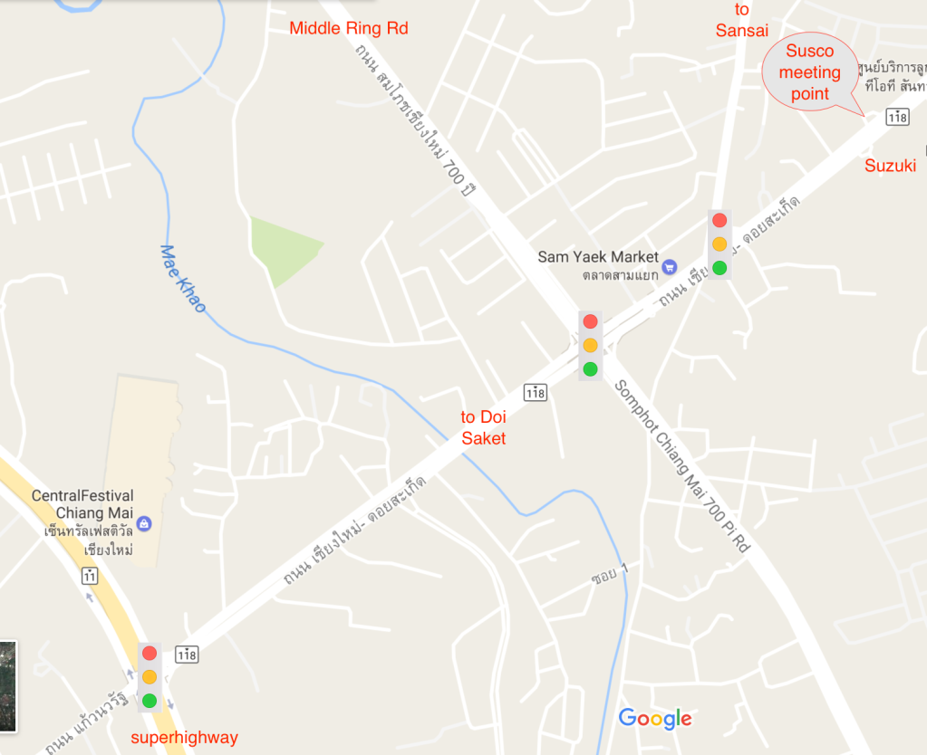
Meeting Point: in front of the ESSO (previously SUSCO) filling station on Highway 118 at 07.20 for a 07.30 departure.

Initially we will drive in convoy for about 40km along Highway 118 to Wat Prabhat Pang Faen, the end point for the hike https://maps.app.goo.gl/sN7B8Q55b8pzfGJd6. Most of the vehicles will be left here and hikers will transfer into the fewest possible vehicles for the 3km onward journey to the hike start point near the village of Baan Huai Mo, where space for parking is very limited. For anyone wishing to drive direct to the hike, please head to Wat Prabhat Pang Faen.
Please bring: as per usual advice (see tabs above), but bearing in mind this is the HOT season pay particular attention to the following:
- Plenty of water and/or electrolyte drink.
- Hat.
- Sun-screen
- A snack or light lunch to consume at the viewpoint.
Filed under: Hike Reports |

